The DroneSense Remote update introduces Augmented Reality overlays in live video, enhancements to log and CFS editing, improved site validation, advisory warning radius display, network testing tool upgrades, new remote maintenance features, manual terrain following in HAT/AGL, and multiple fixes and system improvements to streamline drone operations.
Availability is rolling out by region. See Deployment Status at the bottom of this page for details.
DroneSense Remote Update
| This update applies to organizations with the DroneSense Remote add-on for Drone as a First Responder (DFR) operations and can be accessed at remote.dronesense.com. |
Updates and New Features
NEW: Augmented Reality
This release introduces Augmented Reality (AR) within the Remote Operator window, enabling dynamic, location-based overlays directly within the live video feed. AR includes configurable display options and adaptive visibility controls that respond to gimbal angle and zoom level, ensuring accurate, context-aware visualization during flight operations.
AR Controls & Indicators
Added a new button in the Remote Operator (RO) window to open AR settings.
-
When AR is enabled, the button will indicate if AR cannot be displayed.
-
AR may not display if:
Gimbal tilt is less than 10 percent.
Zoom level is greater than 5x.
-
New AR Settings Panel
AR settings are displayed next to the RO window.
-
Users can:
Enable or disable AR
-
Choose which elements to display:
Street Names
House Numbers
Building Labels
Drone Home Marker
Drone Target Marker
-
Adjust AR behavior based on:
Location
Altitude
Zoom level
Modify street label opacity
Log and CFS Enhancements
New Edit Log Prompt
-
Allows users to quickly configure whether logs can be edited:
Every time
From the CFS menu
New Edit CFS / Case ID Menu
Enables updates to multiple CFS-related options.
-
Accessible from:
Edit Log prompt
Individual CFS entries in the CFS/Case Log menu
Additional Updates
Added an address field for the Pilot in the Flight window (CFS/Case section).
Site Validation Improvements
When configuring a site, new validations and warning messages may appear. Keep these in mind when creating or editing sites.
Max Flight Altitude must be at least 60 ft above Min Flight Altitude.
Min Flight Altitude must be at least 60 ft below Max Flight Altitude.
Default Flight Altitude must be at least 25 ft above Building Height.
Note: If a dock is used on this site, the default height must be at least 20 m (66 ft) greater than the building height.
RTH Altitude must be less than Max Flight Altitude.
Advisory Warning Radius
A radius is now displayed on the map to indicate advisory warning boundaries.
Alerts are sorted by the three closest alerts.
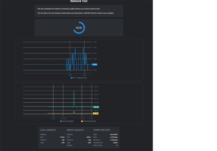
Network Testing Tool (Docks)
-
Added UI improvements, including:
-
Two graphs displaying:
Latency
Inbound/Outbound traffic
Displays location and network information.
-
Remote Maintenance Updates
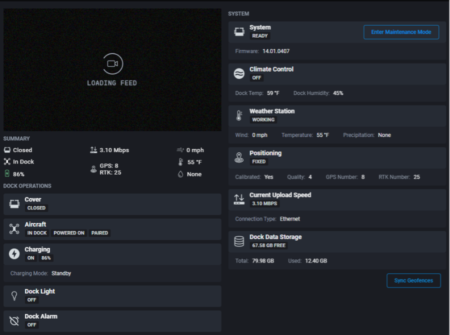
Added new icons to the Remote Maintenance menu.
Renamed “Format Data” to “Erase Dock Data.”
Offline docks can now be reset from the Remote Drones list.
After canceling the restart dialog, the Restart button remains accessible.
Flight & Map Updates
-
Manual Terrain Following is now available in both HAT and AGL modes.
Terrain Following still respects the default HAT flight height.
Users can now switch the altimeter between HAT and AGL mid-flight.
Users can no longer edit launch sites while in flight.
ADS-B layers now remain the top-most map layer.
Recording & Media Improvements
Updated messaging when DJI fails to start recording to clarify that Media Manager continues recording.
The system now waits for the drone to power on before recording or taking photos.
Media MTX no longer attempts to reconnect after the RO ends a flight.
API & System Updates
SafeSky now uses custom API keys when available; otherwise defaults to the DroneSense API key.
Improved refresh token handling.
Updated public dashboard URL to the correct version.
Added cache-control headers so users can see deployed updates without clearing cache.
Improved overall user messaging styling.
Fixes & Improvements
Fixed issue preventing the RTH button from appearing mid-flight.
Removed extraneous WASM compile errors from the console.
Corrected weather model units, translations, and spacing.
Fixed Remote Operator IDs not consistently displaying in flight logs.
Simulated dock flights no longer generate flight logs or CFS entries.
Deployment Status
Availability by region is shown below.
| Server | Status/Date |
| US | Complete - February 25, 2026 |
| CA | Complete - March 2, 2026 |
| UK | Complete - March 2, 2026 |
| EU | Complete - March 2, 2026 |
Share your feedback
Let us know your thoughts on this update!
Share your feedback via our
support form
or by
email.
Comments
0 comments
Article is closed for comments.